The Great Daylight Fireball of July 23, 2001
Observation - Monday, July 23, 2001
My wife and I were sitting on our deck (a few miles south of Millville, PA) about 6:20 EDT when she suddenly directed my attention to a bolide (fireball) in the northwest. I saw it initially in the NW (bearing ~330*) approximately 30 deg above the horizon. It rapidly (within a second or so) traveled behind some sparse tree cover and then below our horizon, bearing ~310 deg. It had a deep orange color and rivaled the sun in brightness (the setting sun was only ~40-60 deg away in azimuth). The direction of travel was roughly E to W. It left a smoke train that was easily seen but disappeared within ~5 min. Approximately 2-3 min later, we heard what sounded like thunder coming from the same direction. The sky was perfectly clear, however, and we soon realized it was either a sonic boom or sound of an impact. When I plotted the bearing at which it disappeared on a topographic map and calculated the distance based on the time-lag of sound, I estimated the boom to come from the Williamsport, PA area.
*Note: Bearings are using a compass uncorrected for magnetic declination and are +/- 10 deg.
The Cornfield - Tuesday, July 24, 2001
Within an hour, I was contacted by a reporter for the Press-Enterprise, the local paper. Apparently many people saw the bolide and had questions. Throughout the evening, local television stations broke into regular programming to bring updates on what had been seen with live telephone interviews with a local amateur astronomer.
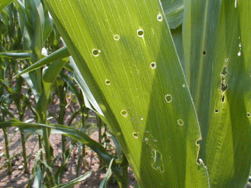
By morning, the media frenzy came to a fevered pitch. CNN had a link on it's webpage devoted to the event. They quoted a fire chief in Salladasburg, PA, as witnessing an unusual patch of corn a nearby farm where it was thought a fragment had broken off and landed. The reports stated that a large, 25 yd x 50 yd patch of the corn field had been knocked over, blackened or scorched, and the leaves curled from heat and peppered with burn holes from tiny fragments that may have landed in the field. The Department of Environmental Protection had been called the previous evening and had conducted a radiation survey of the field to ensure there was no radiation hazard.
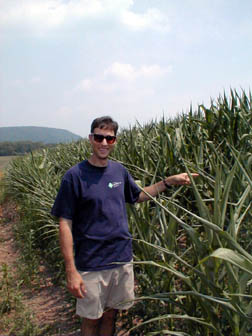
I called the fire chief and arranged a quick trip to investigate the site. Norm Gillmeister, chair of our department and mineralogist extraordinaire came along. We arrived at the field before noon, some 18 hrs after the event. Local television stations were already there, as were a reporter and photographer from the Williamsport Sun-Gazette. When we arrived at the fire station (Larry's Creek Volunteer Fire Dept.), the TV was tuned to CNN and they were broadcasting interviews with local witnesses and showing aerial footage of the now-famous corn field.
To the best of my knowledge, Norm and I were the first scientists on the scene. It was immediately evident that evidence, if any existed, would be elusive. The corn had returned to it's upright position and there was no discoloration evident. We only knew we were standing in the correct area because the fire chief had marked the ground next to the affected corn. The corn leaves were curled, but all the corn was this way because the day was quite hot (~90 deg F) and humid, as it had been the previous day. There was no evidence of scorching. CNN had posted a picture on it's website of a supposed scorch mark, but it was very similar in appearance to dark fungal or other biologically created marks on many leaves. The "burn" holes were evident, and many had interesting geometrical patterns, but they appeared to be simply insect damage. Interestingly, Norm noted that the weeds between rows of corn did not show these holes, further damaging the case for burn holes. We walked the rows, looking for any disturbed areas or unusual material. The task was make easier because the soil was a uniform red clay/shale, and it was well packed because of the lack of rain and heat the previous two weeks. We saw no evidence of disturbed soil, and no evidence of foreign material - meteorite material would have been black. We took a soil sample in case there are microscopic fragments, and will be analyzing it in the next few months. In short, however, it appears to have been a red herring. Other scientists visited after us, and to my knowledge, they have not reached conclusions different from ours.
This appears to have been a case of a story that outran itself. The woman who resided at the farm did not see the fireball, but may have witnessed a bright flash of light. She did experience a strong sonic boom and she, and the rest of the region, swamped emergency personnel with calls. Many thought an airplane had crashed nearby. The fire chief responded to the call from this particular farm, and while interviewing her, noticed the unusual area in the corn field. To my knowledge, there are (unfortunately) no pictures of the field in the condition described as blown down and scorched. The chief investigated the site and called DEP to be safe. The rest is media history.
My best guess, and it is pure speculation, is that animals - perhaps a flock of birds or group of deer - were in the corn when the boom shook the region. Their panic and flight disturbed the corn and kicked up enough dust to discolor the area. All evidence of their presence and flight would have disappeared within a short period of time.
The Search - Saturday, July 28, 2001
On Friday afternoon, I was contacted by Mr. Elton Jones, a local man whose hobby is hunting for meteorites. He noted that DoD satellites had tracked the bolide and emailed the message to me. The track of the bolide was roughly East to West and it disappeared at an altitude of 32km just north-west of Salladasburg - the site of the cornfield. This is presumably where it broke up, and the source of the sonic boom that shook residents there. The estimated yield from optical data was on the order of 3,000 tons of TNT - about one-fifth the yield of the Hiroshima bomb. The estimated size of the bolide was on the order of 20-30 tons, assuming a chondritic (stony) object. Sky and Telescope magazine published a map of the bolide path, shown here.
 95KB Sky
and Telescope story link
95KB Sky
and Telescope story link
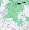
Dr. Peter Brown, Los Alamos National Laboratory, estimated fall points for a variety of sized material. Both the size and uncertainties of the projected fall area are large. A portion of the topographic area is shown here. The white X denotes the estimated impact for objects of ~150 kg, while the arrow shows the estimated range for objects in the 5-100kg size.
 1.5MB Sproul
State Forest link
1.5MB Sproul
State Forest link
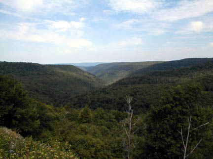
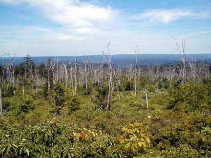
On Saturday, I and three other geologists from Bloomsburg University (Norm Gillmeister and Duane and Ruth Braun) went and explored the area around the white X. As you can see here, however, the Sproul State Forest is quite dense.
 30KB
30KB
Many areas have been logged or burned by wildfires within the past decade or two, and are now covered by extremely thick layers of shrubs, including wild blueberry and huckleberry.
 49KB
49KB
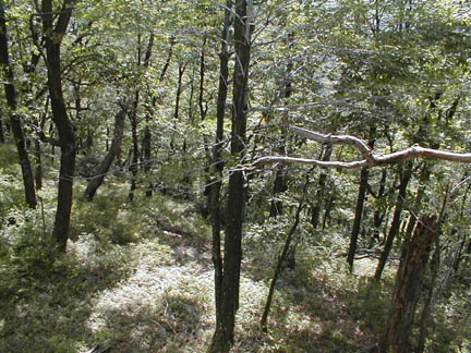
We hiked down into and around the ravine where the X is located, and drove or hiked all the roads or paths around it.
 68KB
68KB
Nothing was found. Parts of this area are state gamelands, so there is still a possibility that someone may stumble upon something.